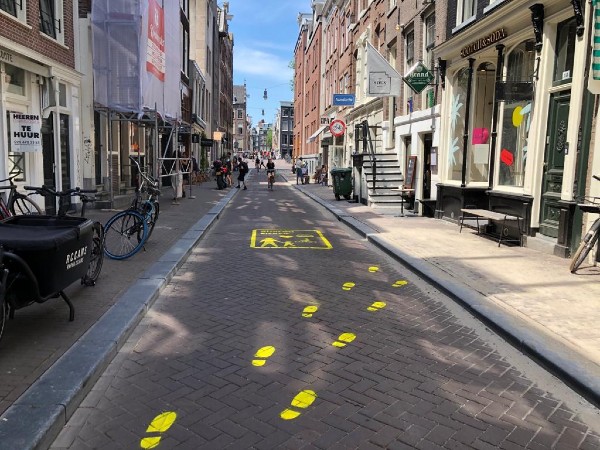
As lockdown measures are relaxed in Europe, ‘Keep your distance’ has replaced ‘Stay at home.’ To help ensure physical distancing, major cities in the Netherlands have been mapped to highlight the routes and places where it is easier to follow guidelines and limit the spread of COVID-19.
“On Google Maps, people are interested in the shortest route, but in our case, we want to get from A to B in the safest way,” explains Achilleas Psyllidis, the main researcher behind the project in an interview with UNRIC.
These roadmaps have been designed by Delft University of Technology (TU) in collaboration with the Amsterdam Institute for Advanced Metropolitan Solutions (AMS Institute) and are available for eight Dutch towns: Amsterdam, Rotterdam, The Hague, Delft, Utrecht, Eindhoven, Groningen and Den Bosch.
They can be found online on ‘The Social Distancing Dashboard’. With the help of various colours, these interactive cards indicate the extent to which pedestrians and cyclists can maintain a distance of 1.5 metres.
Pavements, for example, are divided into four different categories, and take into account the space available to maintain distance from other road users. Pedestrian zones and public transport spots, which are often highly frequented, are also integrated into the dashboard. The university also plans to include places which many people visit, such as supermarkets or shopping centres.
Helping cities adapt
Policy makers in Amsterdam are already using the dashboard in their local policy making, Psyllidis says. on some roads, for example, cars can be refused access to give pedestrians and cyclists more room to follow physical distancing measures.
“The dashboard allows us to locate bottlenecks in the town,” explains Daniel Nagel, campaign adviser for the city of Amsterdam. “Having a complete picture of the space for pedestrians gives a good insight into the roads where it might be difficult to keep a distance of 1.5 metres. Amsterdam can then anticipate this and take measures which reduce the risk of the virus spreading in these places.”
 A package of measures has been adopted in Amsterdam to ensure physical distancing: billboards and banners, road markings, such as lines, arrows and circles, surveillance systems of visited places, limits on the numbers of visitors in parks etc.
“Social media is also used, as well as a vehicle which encourages people in 12 languages to maintain physical distancing,” explains Daniel Nagel.
Maps for Europe
Delft University of Technology is not only discussing the use of its roadmaps in other Dutch towns, such as Rotterdam and Den Bosch. The university also has plans to develop maps in other European Union cities, such as Athens and Paris.
The dashboard will be adapted to each country’s measures. In the Netherlands, for example, a compulsory distance of 1.5 metres must be maintained, but in other countries such as France it is only 1 metre whilst in Greece it is 2 metres.
Sustainable cities and communities
Spatial planning and public spaces in towns play an important role in sustainable development. Sustainable Development Goal (SDG) 11 ‘Sustainable Cities and Communities’ underlines the importance of an equal and inclusive access to public spaces. Accessible public spaces ensure various populations can participate in society and contribute to the safety of cities and their inhabitants.
Additional links:


